Good morning folks! After a pleasant Friday with temperatures soaring into the low fifties we are tracking a potential snow/rain maker that will effect our region late tonight into Sunday morning. Right now computer guidance is struggling with what falls from the sky, but where you live will make a big difference across Central NY. Attached below is an image of the storm depicted by the NAM Model (North American Mesoscale Model). (Courtesy of NCEP/NOAA)
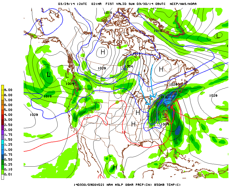
In this image I've circled areas that see snow on this model in Blue, and areas seeing rain in green. As you can see our area lies very close to where these two areas begin to mix. At the current moment I strongly believe that the significant/heavy accumulations will stay west of the I-81 corridor, Mainly south of Rochester in the western Finger Lakes. Now that doesn't mean areas like Syracuse or Cortland can't see snow, it's just more likely that rain mixes in these areas and holds accumulations to minor amounts. With that said, elevation will be play a Critical role in what falls from the sky at your house. Minor adjustments will likely need to be made tonight as the storm bears down so stay tuned here or with your local NWS outlet for the latest!
Now quickly looking ahead to next week, warm air will return ahead of our next storm system on Monday and Tuesday when we may be in the low 60s for a high temperature! Afterwards things cool off a bit. Hang in there folks, Winter is on it's way out the door.
Now quickly looking ahead to next week, warm air will return ahead of our next storm system on Monday and Tuesday when we may be in the low 60s for a high temperature! Afterwards things cool off a bit. Hang in there folks, Winter is on it's way out the door.
 RSS Feed